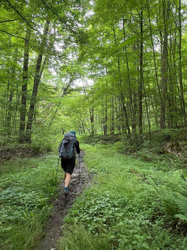
A Wiewald reuinion after 9 years! I can’t walk at all today, but it was worth it. We backpacked 50 miles of the North Country Trail through Allegheny NF in ~44 hours. The trail was mostly muddy but so beautiful. I wanted to quit half way through the 23 mile day, but Amber kept going, so I followed (she had most of the tent, after all ). We nerded out on nature and met some interesting people. Rained a bit on the last day, but we forged ahead for our Allegheny finisher burger.
|
Fun hike on half the Manistee River Trail and half North Country Trail for a 22 mile loop in about 8 hours. 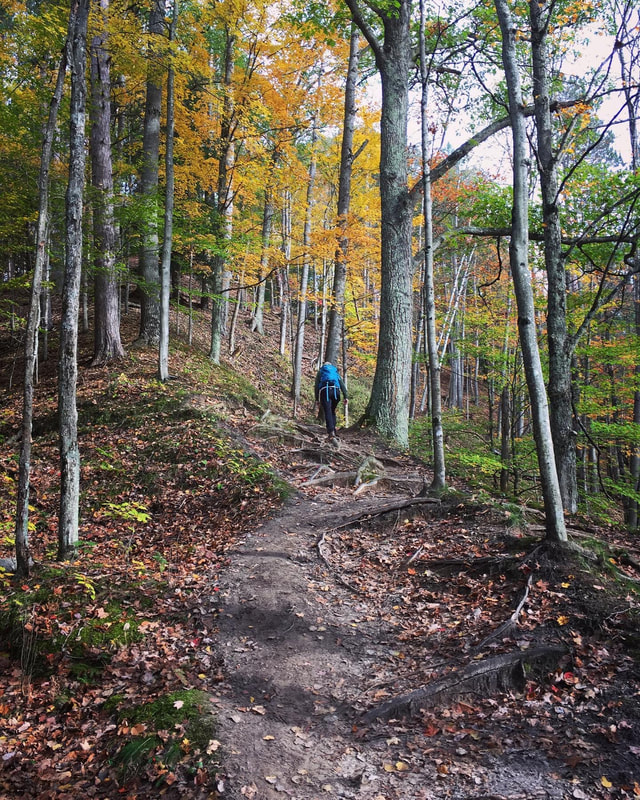 18 mile day hike in fall: Jordan River Pathway and North Country Trail. Check out the short video on You Tube: https://www.youtube.com/watch?v=boxUX5MJqDI&t=5s
We biked 129 miles in about 19 hours. Mud, water, sand, rocks. Check out the short video I made on YouTube: www.youtube.com/watch?v=owfpC0DV9K0 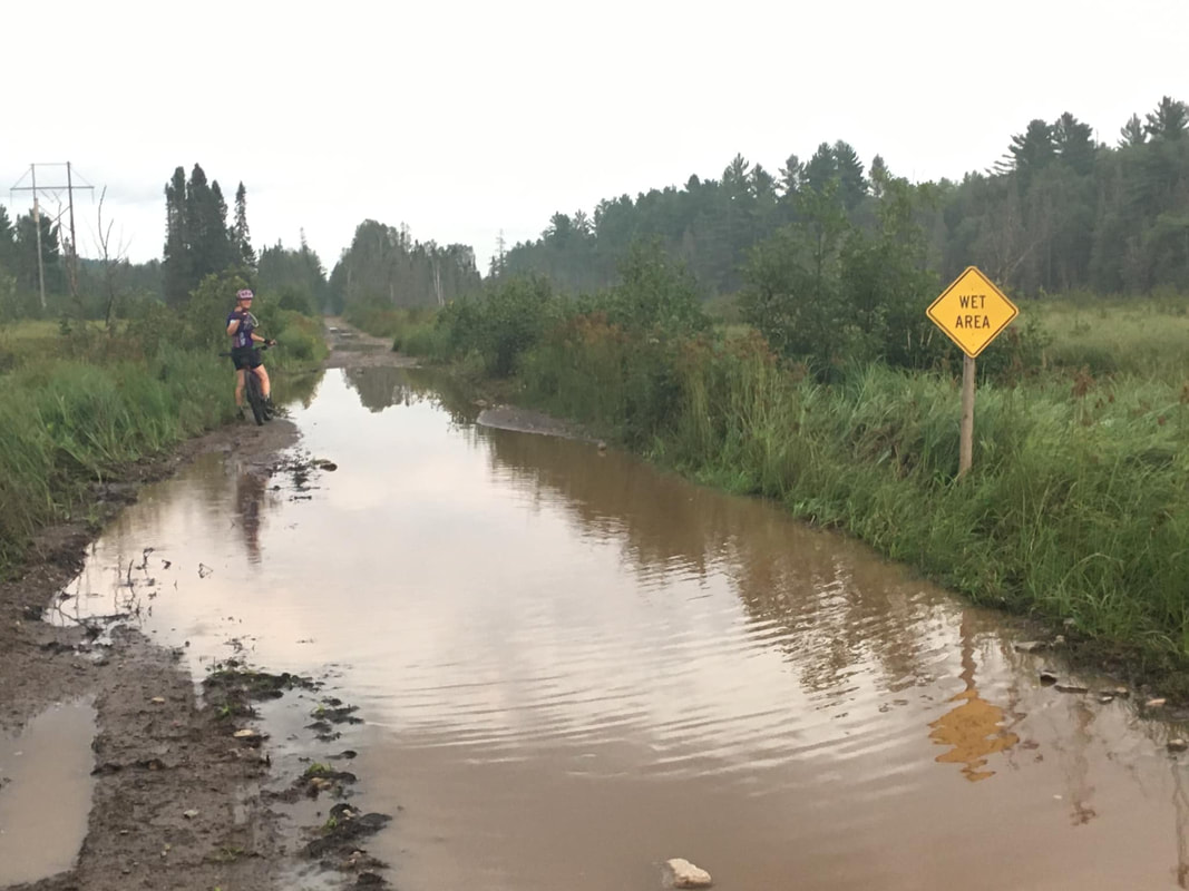 My attempt at riding my gravel bike across the state (200 miles) was thwarted by heavy rain Disappointing to have to drop out of an event, but learned a lot. Made it about half way, taking 9 hours, and decided it wasn't safe to continue. 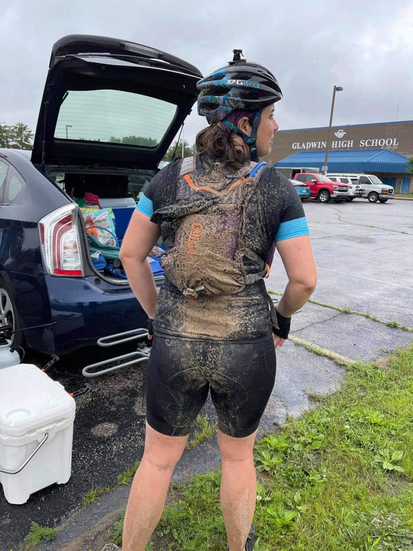 Had an absolute blast riding 50 miles in Allegan County looking for as many bird species as I could in 14 hours. Raised money for Michigan Audubon's Young Birder's Camp. Green Big Day recap: Started rolling at 5am (sunrise 6:15am). First bird of the day was an Eastern Whip-poor-will, closely followed by a Veery. Headed out past wetlands and woods to farm fields to snag my first ever Henslow’s sparrow. By 7am I had found 58 or so species. Next highlight was stopping to record Yellow-billed Cuckoo and finding a Barred Owl next to me. Soon after I had heard both Willow and Alder flycatchers. By 11am things were getting harder but I found a Prothonotary Warbler and Cliff swallows building mud nests under a bridge. As the day started to warm up, I was watching a Scarlet tanager low in a shrub and realized he was right next to a Black-billed Cuckoo. Took a lunch break with a Hooded Warbler singing nearby at 1:30, but it was 90 degrees and the birds had gotten pretty quiet. As I scarfed down 1000 calories in chips & cookies, I tried to come up with the plan to find the final 4 species, but I had mostly seen everything I thought I could without finding warblers or heading to the lakeshore. Last bird of the day was a low & close Broad-winged Hawk. I finally called it quits around 7pm. Need to double check my lists, but looks like 101 species, 50 miles by bike, and 14hrs. 
New bikepacking trip! Check out this story map!
I've used ESRI ArcGIS story maps to highlight some of my adventures. Check this one out!
 The terrain on the first two-track (Rice Lake Rd.) The terrain on the first two-track (Rice Lake Rd.) I’m not sure people really read blogs for information anymore but I’ll try to keep this simple. This section is about the route I chose for my first solo trip. I chose to bikepack the “Straddle Paddle” https://bikepacking.com/routes/straddle-and-paddle/ because it was listed as gravel bike friendly and it had a canoe trip—duh! The original route is about 180 miles, and I ended up modifying it. The route shows most of the campsites in the area but not all. I found a couple of extra ones along the way, which is good to know when you aren't sure how far you'll make it each day. The great thing about choosing a bikepacking.com route is that most of the ground work is already done for you. BTW, it's a great website with all the info you really need to get started. The suggested route starts along the shore but I started at Sawbill Outfitters. I wanted to start with the canoe trip instead of working it into the middle of my ride. This worked out really well. Sawbill has a little shop, showers (for $), and wifi (no cell service). I arrived, did my canoe trip, and then camped overnight. They have a public parking lot (FREE) that you can leave your car in. I packed up in the morning and rode off down the road. I left later than I thought I would on day 1, so I ended up only riding 34 miles the first day. You kind of just need to have an idea of where the campgrounds are and make a judgement call on when to stop for the day. On day two, I continued to follow the Straddle Paddle route but I cut off a section to save time. Instead of going toward Kimball Lake, I went straight down to Grand Marais. This added a much longer section on a fairly busy paved road but it worked out ok. I stopped at Voyager Brewing for a delicious lunch with 4 other bikepackers that I had met. Then I rode back into the woods on the suggested route out of town. I made another change after Pike Lake--I took Honeymoon Trail and ended up at Temperance River campground (not on suggested route map). Prior to leaving for my trip I used Gravelmap.com and other Google resources to make this change. This put me closer to my car just in case, and left out a long section of a trail along the Lakeshore that I didn't really care about seeing (because I'd drive it anyway). The campsite was really nice and just off Sawbill Trail Rd. On day three I knew a storm was coming in so I made another shortcut. But before that, I had to stop at the infamous Trestle Inn for a burger. 4 Mile Grade Rd to the Inn, and then Cramer/Wanless Trail Rd. north to Windy Lake Rd. and I was back on the original Straddle Paddle route headed toward Sawbill Outfitters. Run-down: Day 1: 34 miles, started at Sawbill outfitters, camped at Devil's Track campground. Day 2: 53 miles, camped at Temperance River campground. Day 3 49 miles, headed back to Sawbill Outfitters. Tips and tricks for routes: Use Gravelmap.com, Strava heatmap, RidewithGPS, Trailforks and other online resources to figure out the best roads. Check out the Avenza App. which usually has free downloadable public land maps. They are on your phone but don't require cell service (use GPS satellites). I used the ones for Boundary Waters a LOT. You can also make your own maps and use them in this app--you just need a georeferenced PDF file. Bring some kind of GPS bike computer. I used my phone a lot, but this is much easier. The Dyrt has a great app with campground information. Be brave, it will work out! If its rockier or hillier than expected, that's ok.  Bike all loaded up, I clumsily pushed it to the intersection of two gravel roads and awkwardly hopped on the unusually heavy bike. Riding away from the safety of my car, I couldn’t believe I was finally doing this. Starting a gravel bikepacking trip—just me and my trusty steed (and a lot of snacks).
The plan was pretty simple—to roughly follow the Straddle Paddle route laid out on bikepacking.com. Only about a mile down the road, a shoe fell off my back rack system. Great start. At the 5 mile mark the road was rockier than expected, a two-track road and I had 700x40c tires on a gravel bike set up with panniers. Weaving in and out of rough rocks and ruts, I started to wonder if I had made a mistake. About 10 miles in, my shoe fell off again. I stopped to readjust and was passed by four friendly fellow bikepackers. This calmed my nerves a bit. I pushed on. I did not drive 10 hours to Minnesota to turn around and chicken out! Eventually I exited the dirt two-track and hit some pavement, which was a quite welcome break. I felt myself trying to rush—looking at my GPS for speed and distance. I reminded myself, this is it, this is what you are doing for the next 3 days. Riding your bike. There’s no hurry. Just pedal. Back onto dirt forest roads, I reached a washed out culvert area and instead of worrying about time or how the heck I’d cross it—I stopped to pose my bike and take some photos. I was calm. This was fun. This was what I came for. Solitude. Adventure. Nature. Challenge. I’m a weekend warrior. I’m not big on racing. I started gravel biking 6 months before this trip, and mountain biking a coupe years prior. But, I’ve been a biologist, nature lover, hiker, camper, backpacker, and wildlife watcher for most my life. I love to be outside. With a previous semi-supported bikepacking trip under my belt, and lots of logged gravel miles this year, I finally said, “eff it, I’m going!” By myself. It took me an entire year to finally gain the courage and experience to plan and execute this trip. I looked over gear ratings, planned out what to pack, what to eat, how much water to bring. I looked at national forest maps, gravel maps, Strava, etc. I panned the perfect route! And then barely followed any of it. Which leads me to tip number one. Plan everything, but remember that it will likely change. Be flexible. That’s where the adventure lies. My route changed daily, and I was ok with that. Know what is essential—where the campsites are, where the food and water is. But you can’t control weather, conditions, or mechanical issues. I spent 3 days on the bike, covering about 145 miles and 7,000ft of elevation gain. Not bad for a first solo trip. I stopped to eat at two restaurants and brought the rest of my food. I stayed in two very nice campsites with ample water. The temperatures at night were a little chilly, but I managed to get back to the car before any storms hit. Overall I had a great time. And I want to encourage other women to try bikepacking--solo or with a group of friends. If you enjoy camping or backpacking already, you will surely enjoy bikepacking. Stay tuned for the next installment. I'll talk more about the route I chose, the gear, and the food I ate. I'll try to pass on any tips and tricks I learned, but will also keep it simple. |
Author"That sounds like a horrible idea! What time?" -- describes the way I plan many of my weekends. Archives
June 2022
Categories |


 RSS Feed
