Remote Sensing Analysis from Drone Flights

We are analyzing data collected from drone flights over our GWAS switchgrass plot. This animation was created in ArcGIS Pro and it just represents the growth of the plants from a single date in June to one in July, then August, and finally September. The circles represent a 30cm buffer around the center of each plant.
Stay tuned for more on this project.
Stay tuned for more on this project.
Discover Kalamazoo: Mountain Bike Trails
Working with fellow mountain biker and graphic designer, Allison McKenna, I helped map the local trails for Discover Kalamazoo and Pedal Bicycle shop. The final maps were printed for people to grab and go from both locations. Click on the image to be directed to Discover Kalamazoo's page for viewing or printing. The third map can be found here.

|

|
Volunteer and Just for Fun
These maps were created voluntarily using ArcMap and a touch of Adobe Illustrator for bike related events.


Placemaking and Public Spaces
These maps were created for a “Go Places” event in Kalamazoo, Michigan. The purpose of the event was to continue a community conversation about placemaking, including efforts that are underway in Kalamazoo (e.g., Kalamazoo River Valley Trail, Riverview Launch, Kalamazoo Nature Center’s Urban Nature Park and KVCC/Bronson’s downtown campus and other areas where opportunity awaits). I created a total of nine maps that were printed and used for group discussion at the event. Maps were created using Esri ArcGIS and are property of Kalamazoo Nature Center.


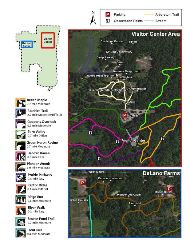
Trail and Grounds Maps
These maps were produced for a specific event held at the Kalamazoo Nature Center, the 2014 ANCA Summit. These meetings are held each summer at a nature center from various locations and bring nature and environmental learning center administrators together for information-sharing, mentoring, training, and professional networking. These were designed to help visitors find their way around at the meeting. They were created using Esri ArcGIS and are property of Kalamazoo Nature Center.

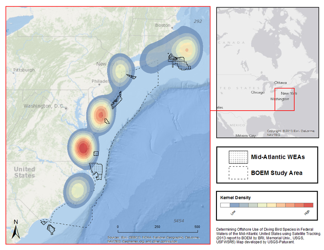
Animal Movements
I assisted a team of researchers with catching seaducks in the Chesapeake Bay to determine habitat use and migratory stopovers using satellite telemetry locations. These maps were produced using ESRI ArcMap for USGS and their partners for a migration study of seaducks on the Atlantic Coast. These maps are the property of USGS should not be reproduced or used for any reason other than an example of products created by L. Vormwald.